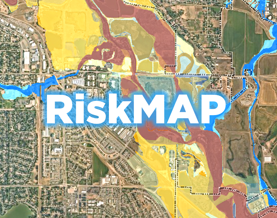
RiskMAP – Updated Floodplain Mapping for the Poudre River#
Updated floodplain mapping is being prepared by consultants for the Colorado Water Conservation Board (CWCB) in coordination with the Federal Emergency Management Agency (FEMA). The new maps only impact the Poudre River in Fort Collins and extend from just west of Fort Collins city limits through Greeley.
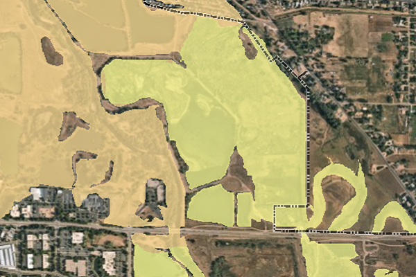
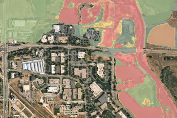
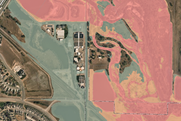
To see how the new map differs from the old, use this interactive map. The older mapping is shown in shades of blue, while the newer mapping is shown in orange coloring.
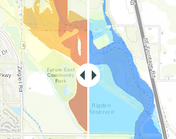
To see the changes in terms of increases and decreases, view this map.
-
It is important to update the maps to have a better representation of current flood risks, which can help protect lives and reduce property damage. The Poudre River floodplain maps are old – 1996 maps based on 1984 topographic mapping – and have been updated in small segments over time. There was a need for a comprehensive remapping using updated data, models and topographic mapping.
Floodplain maps are used for the following purposes:
- Regulating new development
- Designing infrastructure such as bridges, trails and levees
- Flood insurance
- Emergency response planning
- Hazard mitigation funding
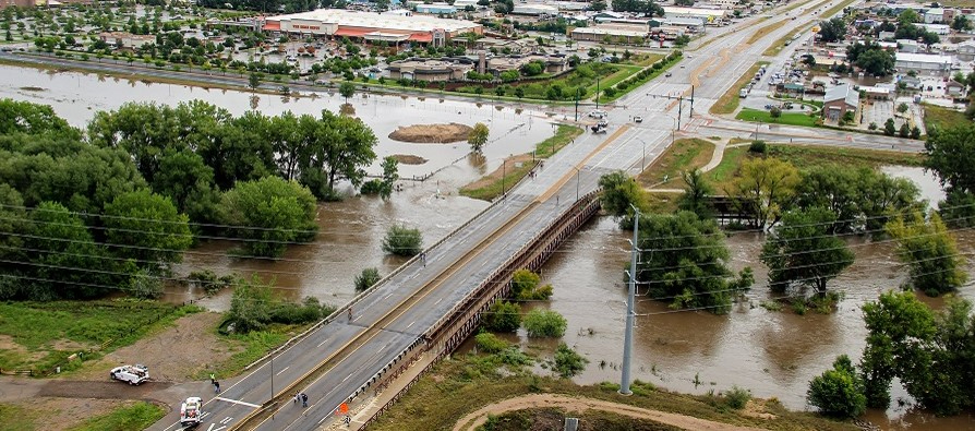
2013 showed just how widespread flooding on the Poudre River can be, and that was only a 25- to 50-year flood. Photos of the event are viewable below. It is crucial to understand the impacts flooding can have on the community so we can be more resilient in the future.
Relevant Documents#
-
Flood insurance is available for all properties in Fort Collins and is strongly encouraged for all structures.
Once the new floodplain mapping becomes effective, lenders will likely require flood insurance for structures mapped in the 100-year floodplain. The cost of flood insurance based on the new mapping could be significant. A property may be eligible for the Newly Mapped discount if it was once designated outside of the Special Flood Hazard Area (SFHA) on an effective Flood Insurance Rate Map (FIRM) and, following a map revision, is designated within an SFHA. The Newly Mapped discount phases out annually until reaching the policy’s full-risk premium. Contact your insurance agent for an NFIP flood insurance premium quote.
CRS Discount
Because of the proactive floodplain management program in the City of Fort Collins, residents and businesses can receive up to a 40% discount on flood insurance premiums. Be sure to ask your insurance agent about the CRS Discount.
General Flood Insurance Information
Visit FloodSmart.gov or call FEMA at 1-800-427-4661.
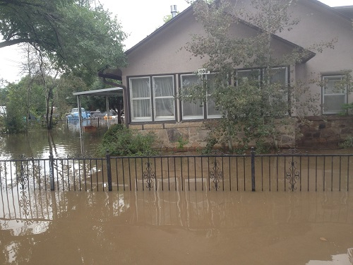
![]()
A flooded home on Vine Drive.
Relevant Documents#
Insurance Information Related to New Mapping
General Flood Insurance Information
-
FEMA will open a 90-day appeal period during which residents can file appeals based on technical data. The 90-day period begins May 18 and ends August 16, 2022.
![How to file an appeal]()
During the Appeal Period
FEMA has prepared this guide that discusses the requirements for supporting data and documentation necessary for filing an appeal. If you plan to submit an appeal, we're here to help. Please call 970-416-2632 to discuss your appeal and the submittal process.
After the Appeal Period
Once the maps are adopted, there are two main ways to make changes to the maps:
- Letter of Map Amendments (LOMAs) – This method allows for corrections of the map due to more detailed topographic information. A FEMA Elevation Certificate is required if the request involves a structure.
- Letter of Map Revision (LOMRs) – By modifying the topography or the flood conditions, applicants can submit new floodplain modeling and mapping and request a map change. All map changes are subject to floodplain regulations that must be met before any grading or development takes place.
FEMA must review and approve both LOMAs and LOMRs. For more information, contact Utilities at 970-416-2632.
Relevant Documents#
-
- If your property is in Fort Collins, contact Fort Collins Utilities at 970-416-2632.
- If your property is in Larimer County outside of Fort Collins city limits, contact Larimer County Engineering at 970-498-5731.
- Floodplain regulations
Relevant Documents#

Poudre River 2013 Flood#
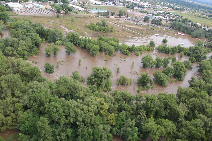
September 2013 flooding along the Poudre River looking north to McMurry Natural Area and Legacy Park. Two thirds of the Poudre River 100-year flood zone is preserved as open space, which allows the water to spread out and slow down without causing damages to structures.
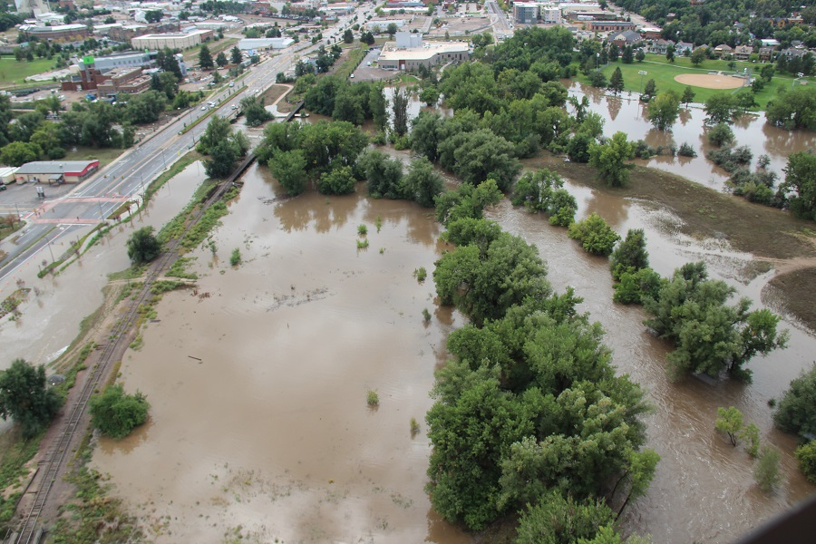
Looking south along College Ave. The water was inches from overtopping the road and flowing to the east.
Looking south, showing water on College Avenue.
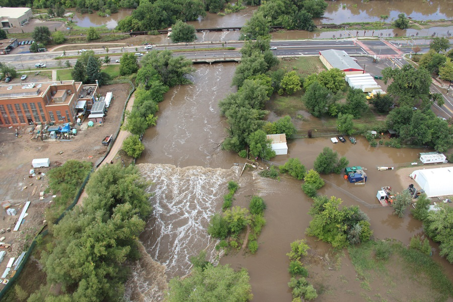
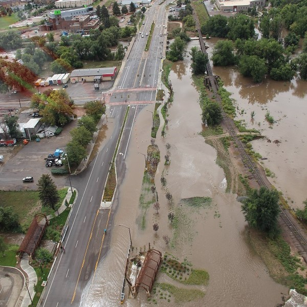
Looking east to College Ave. at what is now the Poudre River Whitewater Park. Floodwater spread out and impacted homes and businesses along Vine Drive. The Whitewater Park is an example of combining recreational amenities and flood protection into one project.
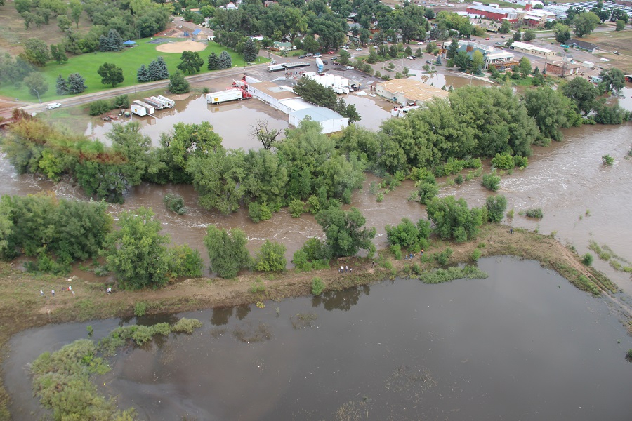
Looking north to Lincoln Ave. Buckingham Park is to the upper left.
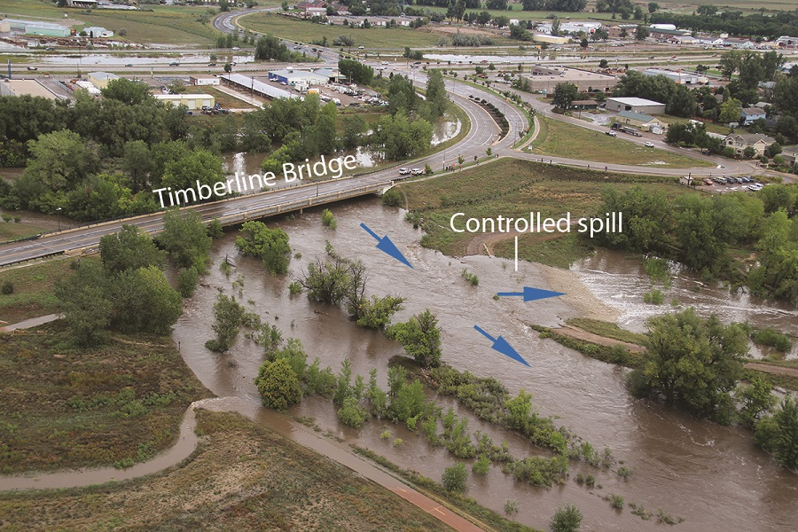
Flooding near Timberline Road, showing the controlled spill that sent water into the Riverbend Ponds Natural Area, where the water could spread out and slow down as it travelled through the ponds.
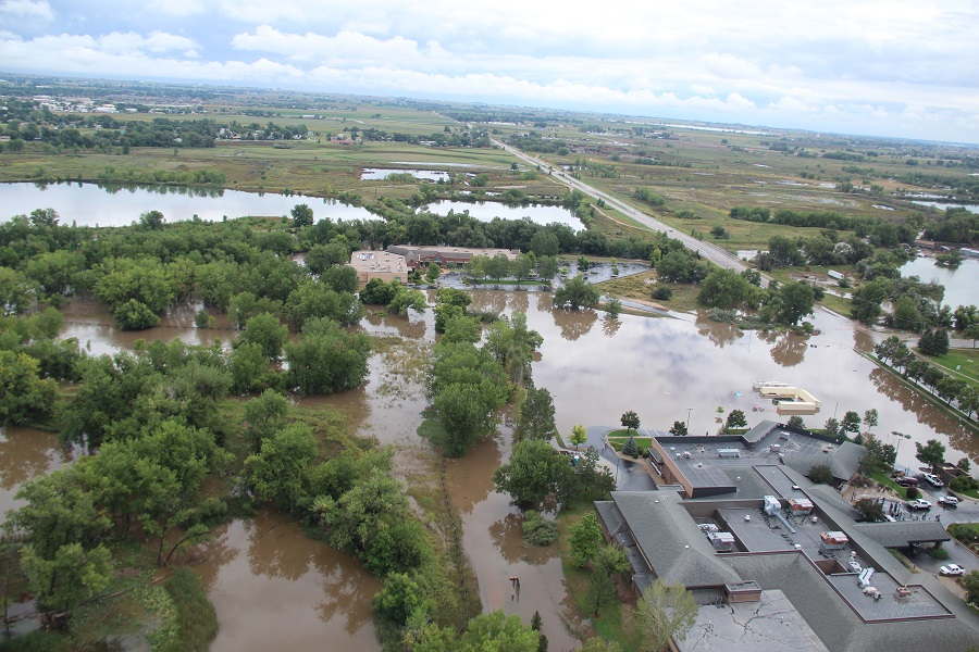
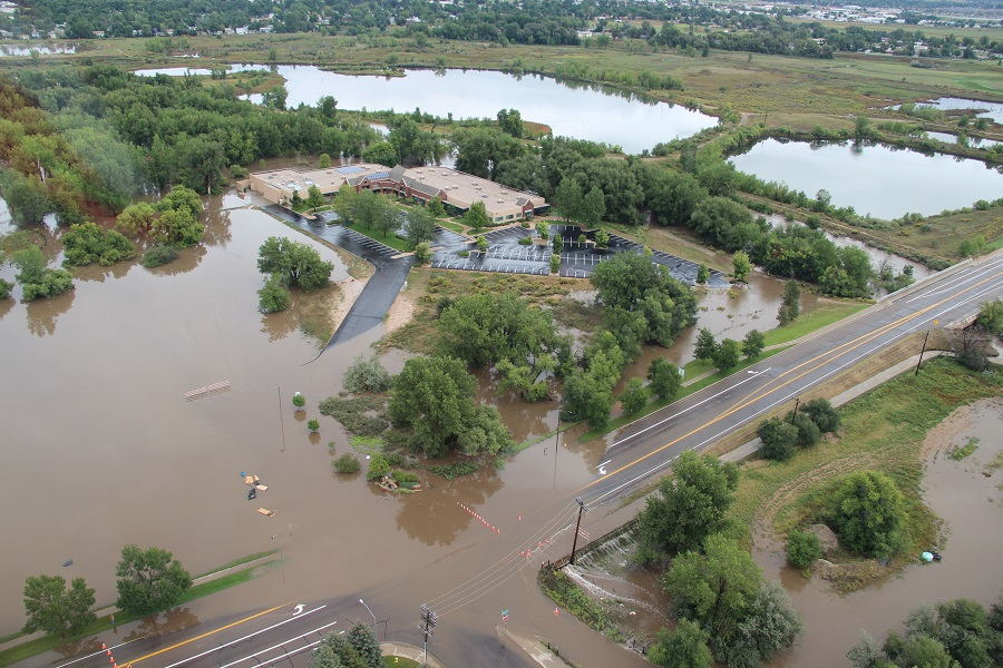
Looking east along Prospect Road. The Orthopedic Center of the Rockies is to the bottom right.
Looking northeast, showing water overtopping Prospect Road at Sharp Point Drive.
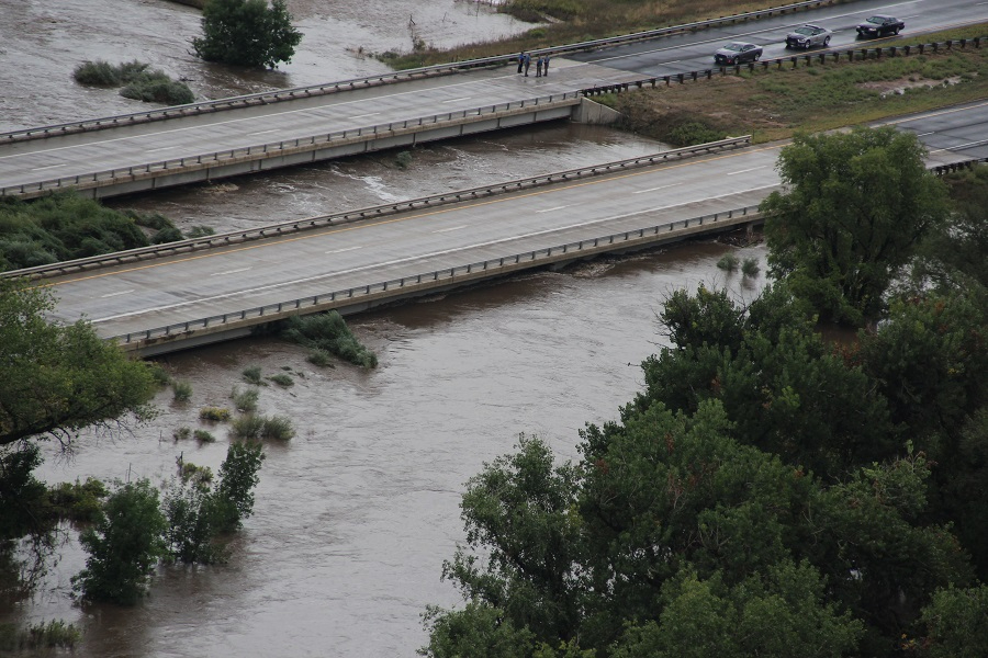
Looking east, showing flooding where I-25 crosses the Poudre River.
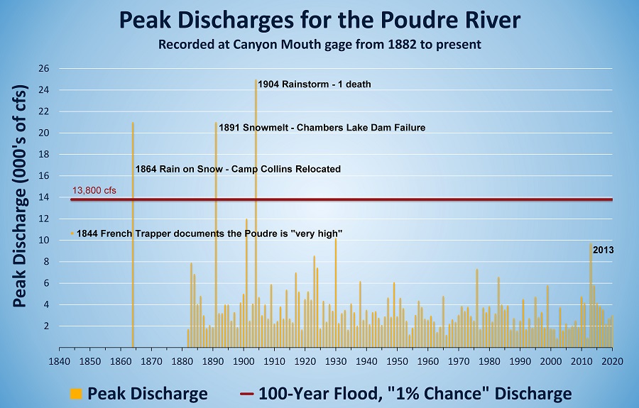
Here is how the 2013 flood compares to past flooding events on the Poudre.
September 2013 flooding along the Poudre River looking north to McMurry Natural Area and Legacy Park. Two thirds of the Poudre River 100-year flood zone is preserved as open space, which allows the water to spread out and slow down without causing damages to structures.
Looking south along College Ave. The water was inches from overtopping the road and flowing to the east.
Looking south, showing water on College Avenue.
Looking east to College Ave. at what is now the Poudre River Whitewater Park. Floodwater spread out and impacted homes and businesses along Vine Drive. The Whitewater Park is an example of combining recreational amenities and flood protection into one project.
Looking north to Lincoln Ave. Buckingham Park is to the upper left.
Flooding near Timberline Road, showing the controlled spill that sent water into the Riverbend Ponds Natural Area, where the water could spread out and slow down as it travelled through the ponds.
Looking east along Prospect Road. The Orthopedic Center of the Rockies is to the bottom right.
Looking northeast, showing water overtopping Prospect Road at Sharp Point Drive.
Looking east, showing flooding where I-25 crosses the Poudre River.
Here is how the 2013 flood compares to past flooding events on the Poudre.
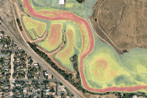
Additional Mapping Products#
FEMA has created additional mapping products to help visualize the flood risk on the Poudre River. These products should be considered as estimates and are not used for regulatory purposes. Please discuss any specifics with Utilities staff at 970-416-2632.
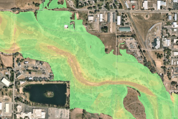
Water-Surface Elevation Grids
Shows the elevation of the water during a 100-year flood.
Percent 30-Year Chance Grids
Shows the chance of seeing a flood during the term of a typical mortgage.
Did You Know?
Fort Collins Utilities is a community-owned utility that manages four essential services – Light & Power, Water, Wastewater and Stormwater.
You can save water when washing smaller loads by selecting the setting for the corresponding water level.
To keep your dryer working at its best, make sure its vent pipe is not kinked or blocked.