Everyone Has Flood Risks – Know Yours#
We must remember that flooding is a natural and reoccurring process. It’s not a matter of if flooding will happen, it’s when. After the 1997 flood, the City ramped up its efforts to reduce development in high-risk areas, improve floodplain mapping, and implement ongoing public outreach and education to inform residents of their risk.
It may be hard to believe, but urban areas that are not directly adjacent to a river, such as Downtown Fort Collins, are still at risk for flooding. In fact, parts of the downtown area are more at risk for flooding than areas developed after the 1980s when design standards for storm drainage were put in place.
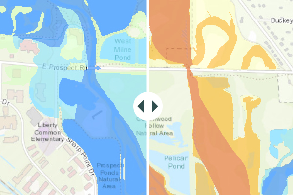
Floodplain Map
View Federal Emergency Management Agency (FEMA) and City floodplain maps to determine if your property is in a floodplain.
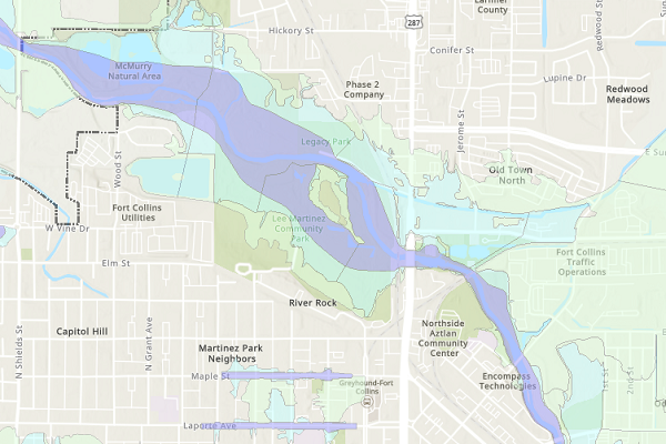
Poudre River RiskMAP
As part of a remapping effort on the Poudre River, FEMA has released preliminary maps for Fort Collins. These revisions may change your requirement or cost for flood insurance.
For more information, please call 970-416-2632.
Stop! Read First#
Always look at the maps for both the FEMA floodplain and City floodplains to determine if a property is in a floodplain
Although City maps show areas outside city limits, do not use the maps to make floodplain determinations in Larimer County. Contact Larimer County Engineering at 970-498-5700 for County floodplain map information.
Please refer to the CSU Floodplain Management website for floodplain mapping and requirements on CSU’s Main Campus.
You can also obtain a copy of the FEMA maps on the FEMA website. Check out FEMA's tutorial to learn how to create a specific map.
-
These maps do not reflect FEMA Letters of Map Revision based on Fill (LOMR-F) or Letters of Map Amendment (LOMA).
View a list of properties (PDF 11KB) for which these LOMA and LOMR changes have been issued.
-
-
It may be hard to believe, but urban areas that are not directly adjacent to a river, such as Downtown Fort Collins, are still at risk for flooding. In fact, parts of the downtown area are more at risk for flooding than areas developed after the 1980s when design standards for storm drainage were put in place.
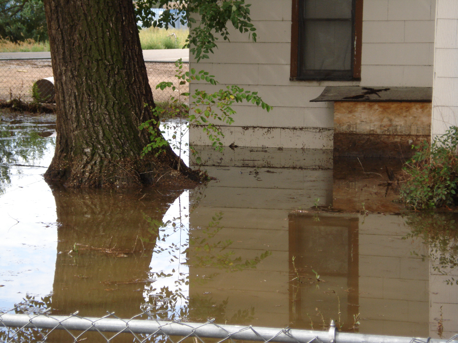
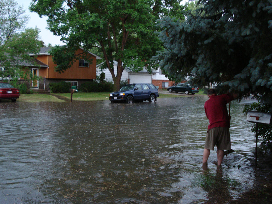
Street flooding is the biggest problem in this area because of the huge risk to public safety. Think about the potential for water filling up a basement resulting in costly damages and the potential for loss of life. While not as dramatic as some of the floods along the river, just six inches of flowing water can knock a person over, and one to two feet of water is enough to carry away your car.
Addressing the issue head-on, the City of Fort Collins is developing a plan to reduce and control street flooding. The Downtown Stormwater Improvement Plan (DSIP) will address flood risk and improve stormwater quality through a system of large pipe projects and green infrastructure enhancements. This long-term investment in the community will ultimately decrease the life-safety risk and property damage in the downtown area during large rainstorms.
August 2007 – Flooding on Airpark Drive.
July 2, 2008 – Street flooding on Constitution Avenue.
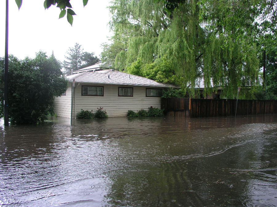
2009 – Street flooding on Plum Street.
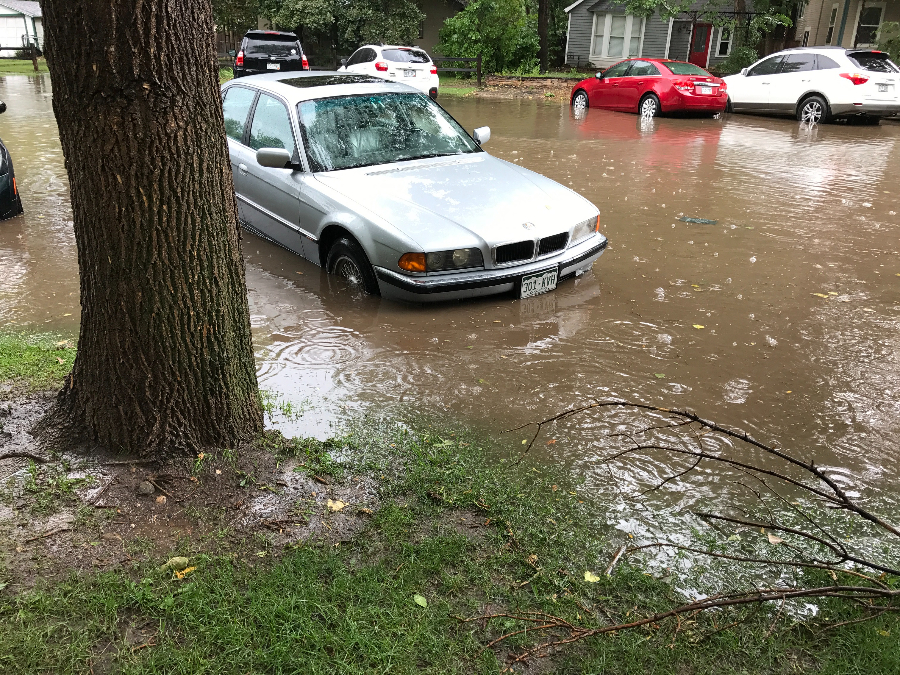
August 10, 2017 – A quick rainstorm resulted in street flooding near City Hall.
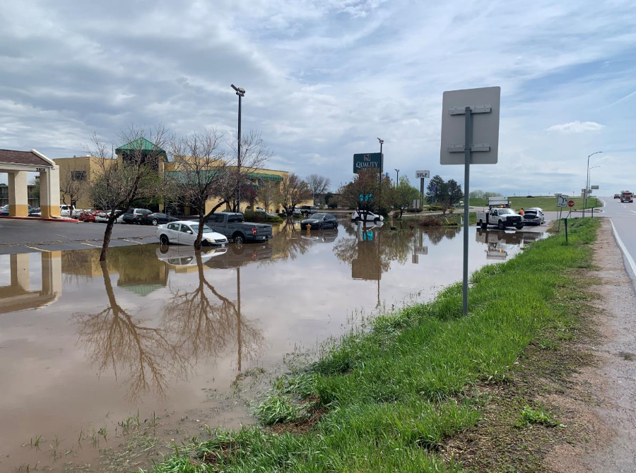
May 14, 2020 – Flooding due to poor drainage along the Mulberry Frontage Road near I-25.
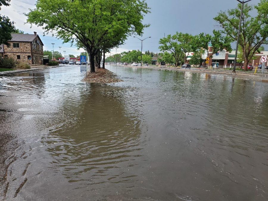
May 31, 2020 – Flooding on College Avenue south of Drake Road.
August 2007 – Flooding on Airpark Drive.
July 2, 2008 – Street flooding on Constitution Avenue.
2009 – Street flooding on Plum Street.
August 10, 2017 – A quick rainstorm resulted in street flooding near City Hall.
May 14, 2020 – Flooding due to poor drainage along the Mulberry Frontage Road near I-25.
May 31, 2020 – Flooding on College Avenue south of Drake Road.
Did You Know?
Planting shade trees to block unwanted summer sun is a good, long-term approach if you plan to be in your home for many years.
Xeriscape is a healthy, attractive landscape that conserves water.
Cleaning your dryer filter regularly prevents lint build ups that can reduce airflow resulting in clothes not drying completely.