Proposed Improvement Maps#
Fort Collins is divided into 12 drainage basins. Locate the basin number on the map and click the corresponding link below to see proposed improvements in that basin.
Learn more about the Stormwater Master Plan update.
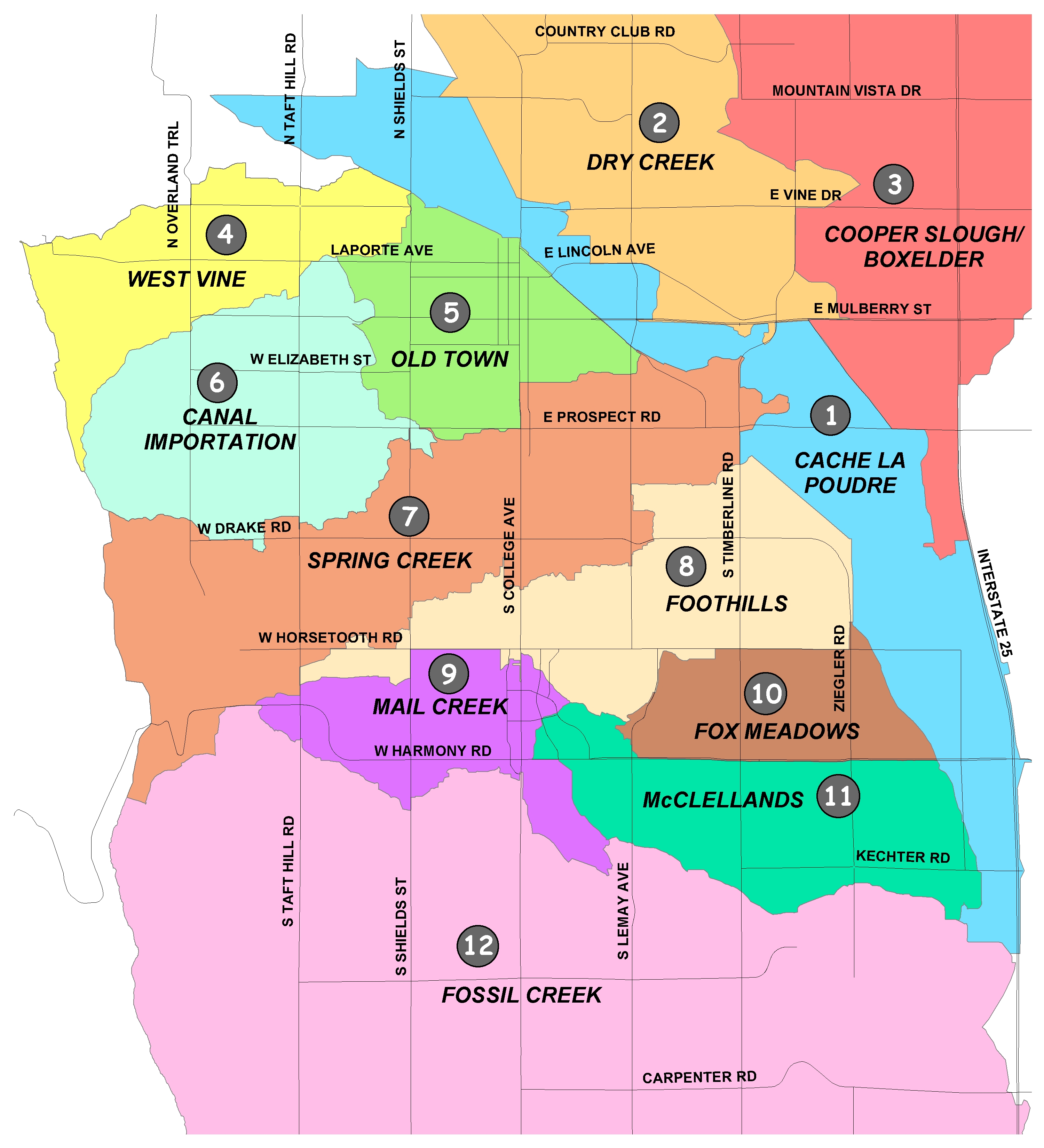
Improvement Maps by Drainage Basin#
- Cache la Poudre - none proposed
- Dry Creek (PDF 14.7MB)
- Cooper Slough/Boxelder (PDF 3.9MB)
- West Vine (PDF 1.2MB)
- Old Town (PDF 3.3MB)
- Canal Importation (PDF 4.3MB)
- Spring Creek (PDF 3.5MB)
- Foothills (PDF 14.4MB)
- Mail Creek (PDF 14.1MB)
- Fox Meadows (PDF 1.0MB)
- McClellands (PDF 1.2MB)
- Fossil Creek (PDF 1.2MB)
Did You Know?
Shrubs and trees require less water than bluegrass, so it's best to water them separately.
Installing ENERGY STAR® roofing material with high reflectance can reduce cooling load.
Wearing an extra layer of clothing during the winter and lowering the thermostat a few degrees can help save money and energy.