West Vine Drainage Basin#
Past Opportunities to Provide Feedback
Feedback was accepted in the first part of 2021. Click the link below for more information.
Overview#
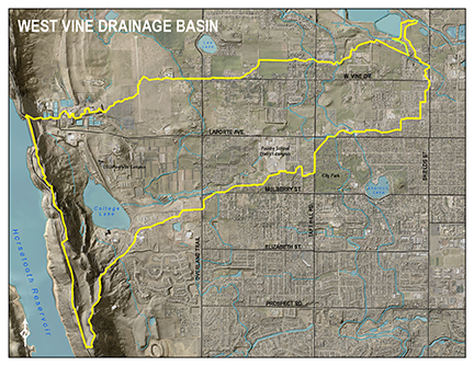
click to enlarge
The West Vine Basin, located in northwest Fort Collins, extends east from Horsetooth Reservoir to the Cache la Poudre River and south from West Vine Drive to Mulberry Street and Laporte Avenue. The total basin area is approximately 2,350 acres. Less than 15% of the basin is within city limits; the rest is in unincorporated Larimer County.
In general, the basin drains from west to east along five flow paths that are not well defined. Throughout the years, development has occurred over the historic flow paths limiting their capacity to convey stormwater runoff. Most of the basin's drainage facilities are inadequate during any storm event and, as a result, drainage problems occur often.
Four irrigation canals cross the basin generally from north to south. The three main canals which impact stormwater drainage in the basin are the Pleasant Valley and Lake Canal (PV&L), the New Mercer Ditch (NMD) and the Larimer County Canal No. 2 (LC2). These canals intercept stormwater runoff as it moves down through the basin and transport it south into the adjected Canal Importation Basin.
During heavy rainfall events, stormwater entering the irrigation ditches overwhelms the capacity, and results in uncontrolled spills in numerous locations throughout the basin. These spills contribute to flooding issues. Future stormwater improvements in the basin will be directed at separating stormwater runoff from the irrigation ditches to eliminate spilling of the ditches during heavy rainfall events.
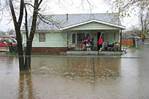
Flood History
During rainfall events, runoff generated within the basin travels from west to east flooding low-lying areas where historic channels have disappeared. Development over the years left some areas with inadequate or undersized stormwater infrastructure while other areas have no stormwater infrastructure at all.
Basin Stormwater Master Planning
The original stormwater master plan for the West Vine Basin was completed in 1980 and updated in 1998. Consistent with other major drainage basins within the City, a comprehensive update to the 1998 study was completed in 2002.
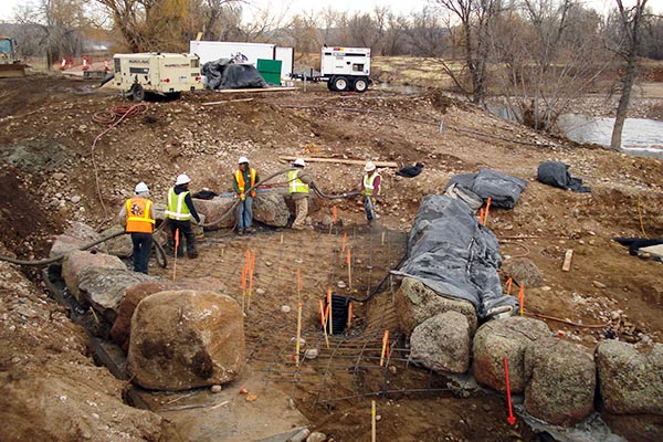
West Vine Capital Improvement Projects
Stormwater capital improvement projects (CIP) are identified in the Basin Master Plan and are intended to help reduce flood risk flooding during a 100-year storm event. CIPs also provide an opportunity to incorporate parks, open space, trail systems, habitat enhancement and water quality improvements.
Explore the West Vine Basin#
Looking west from the Poudre Trail at the lower West Vine Outfall Channel confluence with the Poudre River.
Looking north along the lower West Vine outfall channel as it meanders toward the Cache la Poudre River. The Poudre Trail connection at Lancer Drive can be seen running along the west side of the outfall channel.
The Arthur Ditch as it runs southeast under the Poudre Trail connection at Lancer Drive.
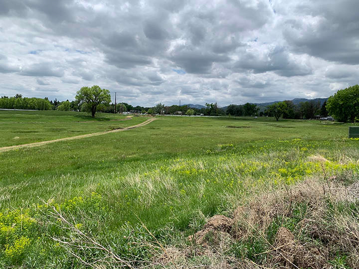
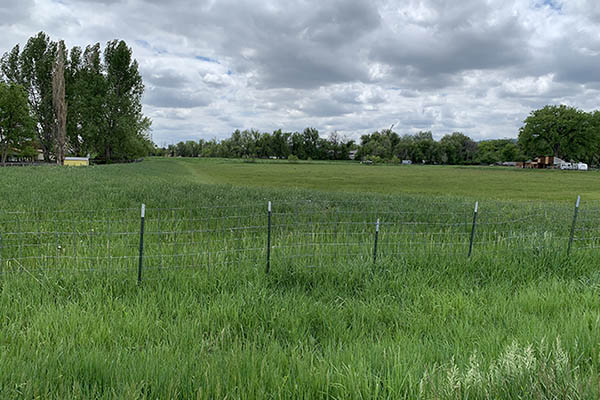
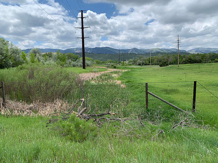
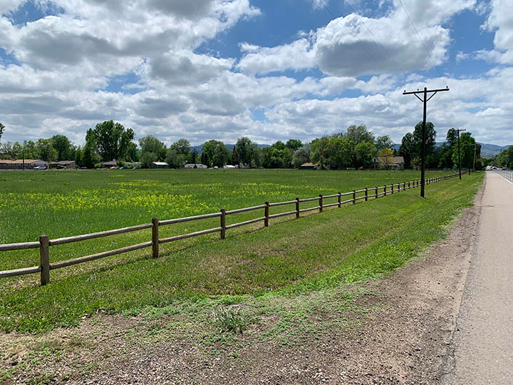
The Puente Verde Open Space property southeast of Vine Drive and Taft Hill Road. This property was purchased by the City back in 2012 for the purpose of constructing a future detention pond to help reduce flood risk to downstream properties and preserve open space in the basin.
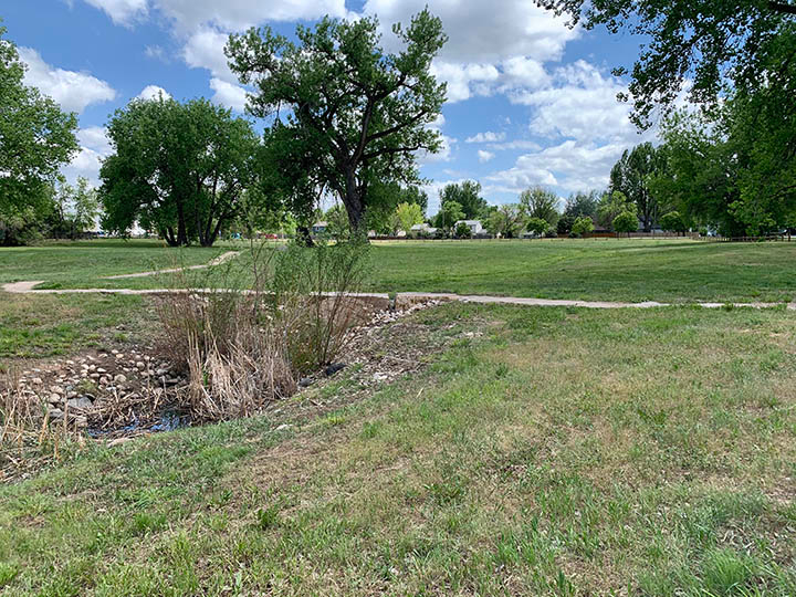
One of the few remaining segments of the historic Solder Creek located west of Overland Trail. Development encroachment and the redirection of stormwater runoff by irrigation canals that traverse the basin caused this natural tributary to become disconnected from the Poudre River.
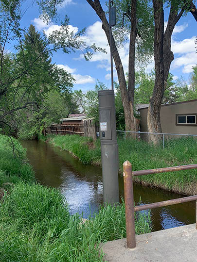
The New Mercer Canal as it passes under Laporte Avenue. The standpipe shown in this photo is part of the City of Fort Collins' flood warning system and monitors water levels in the canal.
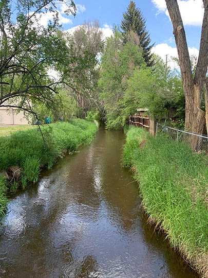
The New Mercer Canal as is flows through the west Vine Basin. In many locations, homes and other structures are located directly adjacent to the canal.
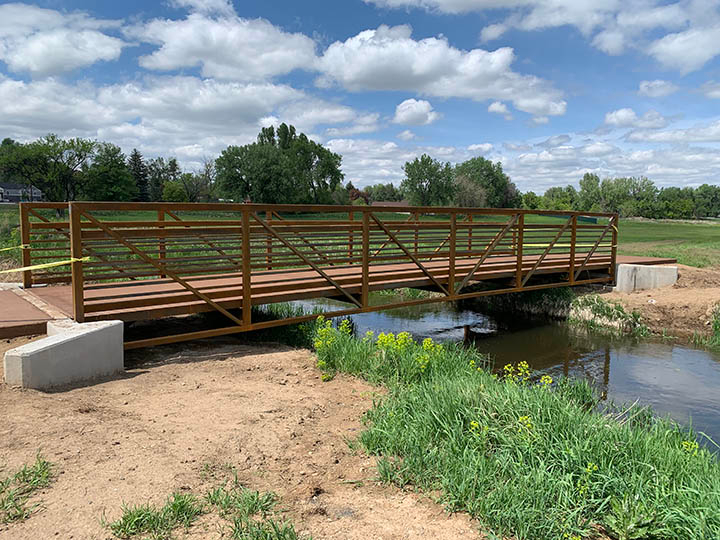
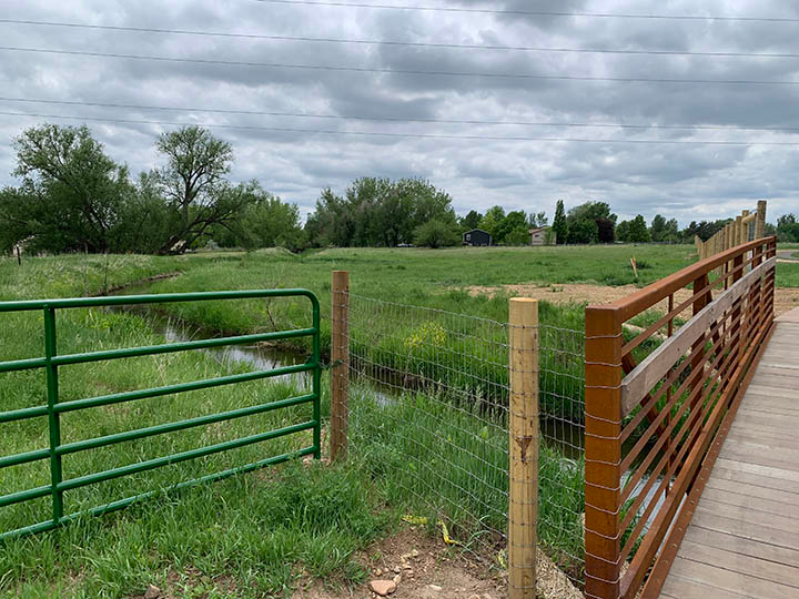
A new pedestrian bridge that was installed as part of the Puente Verde Trail connection project east of Taft Hill Road.
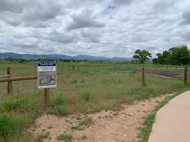
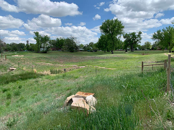
Open space purchased by the City of Fort Collins south of Vine Drive adjacent to the Granada Heights Neighborhood. This property will be part of the next section of the West Vine Outfall Channel.
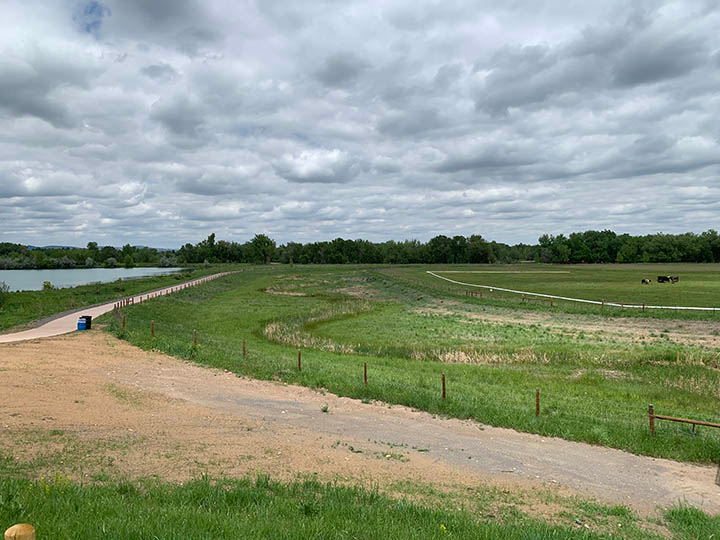
View of the lower West Vine Outfall Channel and detention pond constructed in 2015 north of Vine Drive.
Another view of the lower West Vine Outfall Channel and detention pond north of Vine Drive.
Looking west from the Poudre Trail at the lower West Vine Outfall Channel confluence with the Poudre River.
Looking north along the lower West Vine outfall channel as it meanders toward the Cache la Poudre River. The Poudre Trail connection at Lancer Drive can be seen running along the west side of the outfall channel.
The Arthur Ditch as it runs southeast under the Poudre Trail connection at Lancer Drive.
The Puente Verde Open Space property southeast of Vine Drive and Taft Hill Road. This property was purchased by the City back in 2012 for the purpose of constructing a future detention pond to help reduce flood risk to downstream properties and preserve open space in the basin.
One of the few remaining segments of the historic Solder Creek located west of Overland Trail. Development encroachment and the redirection of stormwater runoff by irrigation canals that traverse the basin caused this natural tributary to become disconnected from the Poudre River.
The New Mercer Canal as it passes under Laporte Avenue. The standpipe shown in this photo is part of the City of Fort Collins' flood warning system and monitors water levels in the canal.
The New Mercer Canal as is flows through the west Vine Basin. In many locations, homes and other structures are located directly adjacent to the canal.
A new pedestrian bridge that was installed as part of the Puente Verde Trail connection project east of Taft Hill Road.
Open space purchased by the City of Fort Collins south of Vine Drive adjacent to the Granada Heights Neighborhood. This property will be part of the next section of the West Vine Outfall Channel.
View of the lower West Vine Outfall Channel and detention pond constructed in 2015 north of Vine Drive.
Another view of the lower West Vine Outfall Channel and detention pond north of Vine Drive.
Did You Know?
Want to save money and be efficient? Try pre-heating your home before 5 p.m. in the winter and coasting through on-peak hours. Try pre-cooling your home before 2 p.m. during the summer and coasting through the on-peak hours.
Setting your air conditioner's temperature higher and using portable fans or ceiling fans helps keep your house cool while saving energy.
Installing high-efficiency refrigeration equipment at your business, such as zero-energy doors and anti-sweat heater controls (rebates available), can save money.