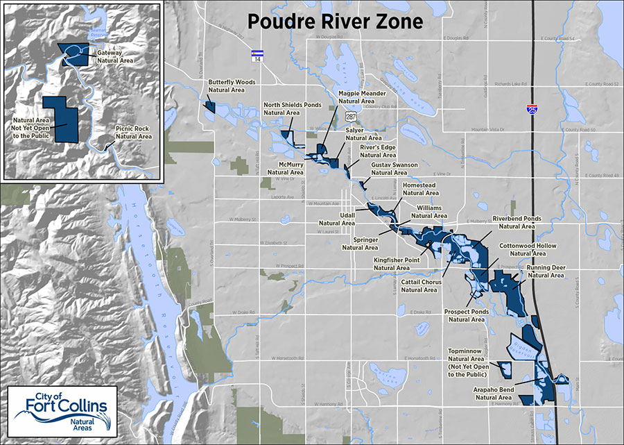
Poudre River Zone#
The Poudre River Zone includes all the City of Fort Collins natural areas adjacent to the Poudre River from Gateway Natural Area, located seven miles up in the Poudre canyon, through Fort Collins to Arapaho Bend Natural Area where the river flows under Interstate 25. The natural areas further upstream tend to be smaller (< 50 acres) compared to the larger sites downstream of Timberline Road that together form vast tracts of continuous floodplain habitat.
These natural areas form the backbone of a rich ecological corridor right through the heart of Fort Collins. This quality of habitat in town is possible due to the foresight of the community several decades ago to purchase and preserve floodplains and current efforts to keep more water in the river through projects like the Poudre Flows Project and the ELC Flow Restoration Project. The Poudre River is widely understood to be an iconic feature of Fort Collins offering the community an incredible array of recreational opportunities and community benefits, and its health is directly supported through the purchase and stewardship of these natural areas.
City of Fort Collins Natural Areas uses Conservation and Stewardship Planning, a planning method to facilitate well-managed natural areas that provide habitat, scenic value, and appropriate recreation opportunities for the community.
Eastern Larimer County is divided up into six management zones based on geography, including the Poudre River Zone.
The Poudre Zone contains 22 natural areas totaling 2,011 acres. While two properties are located in the cooler narrower canyon, the majority of natural areas in this zone are located along the Poudre after it has emerged from the mountains and begun its transition into slow warm meandering river of the Great Plains. For many thousands of years the river deposited fertile soils, gravel and cobble in its floodplain so over the past century lands in the Poudre Zone have been used extensively for agriculture and gravel mining.
Today, interspersed with the natural areas, the floodplain consists of a patchwork of private and public ownership where is land uses include urban infrastructure such as bridges and roads, active gravel mining operations, agriculture, stormwater infrastructure and City parks. Nevertheless, because of the extensive public natural area lands, visitors to the Poudre Zone can experience incredibly rich plant communities, local and migratory wildlife, soothing sounds of the river, and sweeping views of the mountains all within minutes of downtown. The experience is enhanced by a network of 40 miles of paved and soft surface trails co-managed by the City Natural Areas and Parks departments.
Sites within the Poudre River Zone#
Visit each site page to learn about recreation opportunities hours and related information
North Shields Ponds Natural Area
The natural areas in the Poudre Zone provide undeveloped spaces to support a mosaic of habitats including the cottonwood forests that line the river and surround the many ponds, wetlands, and arid upland grasslands. The river and extensive network of ponds support various native and recreational fishes. Likewise, the plants and wildlife in this corridor are a new mix of native and non-native species.
Early European visitors to the region provide insightful descriptions of the former simplicity of the vegetation and abundant wildlife of this landscape. On 1842 John C. Fremont, member of the U.S. Topographical Corps, described the Poudre as “a very beautiful stream, one hundred feet wide, flowing with a full swift current over a rocky bed. We halted under the shade of some cottonwoods with which the stream is wooded sparingly.”
In 1907, explorer Mr. J. R. Todd wrote: “the waters of the river were as clear as crystal all the way down to its confluence with the Platte. Its banks were fringed with timber not as large as now, consisting of cottonwood, boxelder, and some willow. The waters were full of trout of the speckled or mountain variety. The undulating bluffs sloped gently down to the valley which was carpeted in the most luxuriant grasses ... Game was plentiful, herds of buffalo were seen on the plains, as well as deer, elk, and antelope. To the travelers the Poudre Valley appeared to be the hunters’ paradise.”
Today due to dewatering, armoring of the banks, and non-native species the river ecosystem is so fundamentally and extremely different from its native ecosystem that the management challenges in promoting native flora and fauna are persistent and extensive. Fortunately, in recent decades creative and collaborative efforts between City departments, and partnerships with local and regional agencies, have led to many restoration successes and improvements up and down the Poudre.
Water and Physical Habitat
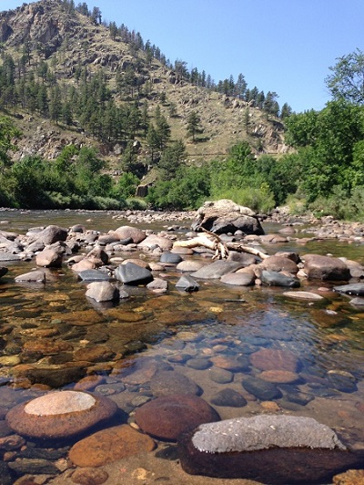
The Poudre Zone properties all sit in the floodplain of the Poudre River. Over many years the river’s course meandered greatly leaving behind it a floodplain that is up to two miles wide in some places. This broad floodplain is characterized by a series of relatively flat terraces and periodic bluffs of rich habitat inextricably tied to the river.
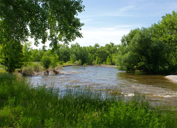
Water is the single driving factor in creating and sustaining healthy habitats in the Poudre Zone. Poudre river flows influence the entire floodplain. Flows rise in spring and early summer in response to snowmelt and drop drastically resulting in low flows, or dry river in places much of the fall and winter. All native plants and wildlife evolved with and are dependent on this impressive annual fluctuation in water. During the highest flows, usually in early June, the riparian or riverside habitats depend on flows that overtop the rivers’ banks to scour away old vegetation, deposit fine nutrient rich sediment and seeds, and inundate soils for weeks at a time creating hostile conditions for non-native vegetation and at the same time creating ideal conditions for native wetland plants, cottonwoods or willows to thrive.
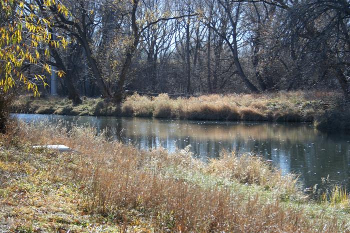
Ground water and pond water levels also fluctuate (albeit a bit more gradually) in response to changes in the river flows. Shallow groundwater conditions provide critical sustenance for all riparian plants. The many ponds within this corridor, all entirely man-made due to resource extraction, also have various impacts on normal groundwater movement by blocking or altering flow, allowing for increased evaporation, and acting as flow paths (or resistance) for flood waters to move safely through town.
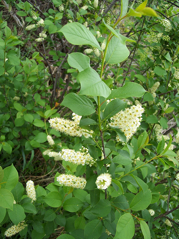
Chokecherry
Plant Community
Prior to European settlement the uplands of the Poudre Zone were shortgrass prairie spotted with occasional upland shrubs. Today some of the grasslands in the zone have been farmed, grazed, or otherwise converted to nonnative plants. One unfortunate outcome of the dominance by non-natives is structural homogeneity and presence of too much plant material which can be so persistent it prevents the native plants and wildlife that evolved with the sparser, shortgrass prairie from thriving.
Similarly, the riverside forests along the river were simpler, with fewer species and more thinly wooded compared to today’s forests. Describing the simplicity of these plant communities C. A. Duncan, who arrived in the Poudre Valley as a child in 1865, wrote in his memoirs: There was but scant growth of trees along its banks. About the only grove near Timnath was on the east side of the river just south of what was known as the Strouse [sic] bridge ...
Today, the forests are more diverse and are thicker than the simple native cottonwood forests. The local revered giants, the cottonwood trees still dominate the forests with their ever-present side kick, the willows. However, many nonnative plants also live along the Poudre. Some species have escaped from urban landscapes, some have invaded as noxious plants, and some such as green ash have simply expanded their territory by migration up the river. Regardless, the lack of natural scour, erosion, and flooding is the leading reason why these nonnative plants are able to thrive. Overall, the plant communities in the Poudre Zone are mostly in moderate to fair condition, implying that these sites are neither entirely native nor entirely non-native.
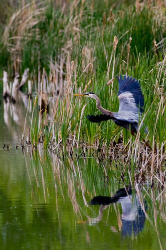
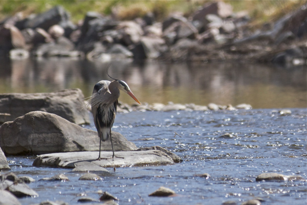
Blue heron
Wildlife
Riparian habitats support 80% of all Colorado wildlife yet constitutes only 2-4% of the land in Colorado. The extensive efforts to preserve and maintain healthy habitats along the Poudre all have the greater purpose of supporting native local or migratory wildlife. Fish in the river are a mix of species found in the mountains and those natural occurring in the warm plains rivers. The greatest stresses on these fish is the significant alteration of flows, the presence of invasive or predatory non-native fish, and lack of quality habitat at each specific river reach. Fish in the ponds are a different mix of native, recreational, and non-native species.
Large ungulates such as white-tailed and mule deer are common as are mid-sized predators such as red fox and coyote. Mink are less frequently sighted and in very rare instances otter are observed. Omnivores, such as raccoons and skunks thrive throughout urban areas and are common along the river. Herbivorous mid-sized mammals include muskrats and beaver. Muskrats are more abundant in extensive cattail marshes but are occasionally seen along the Poudre River. Beaver are found throughout the system, and have a complex role in urban rivers. Movement of mammals along the river has not been well investigated although it can be assumed that movement patterns directly correlate with the connectivity and size of required habitat.
Over the past decade, the Natural Areas Department has conducted a bat survey and multiple years of breeding bird surveys on all Poudre Zone properties. These surveys underscore the notion that birds and bats also rely disproportionately on the river for habitat, food and critical migratory layover habitat. In fact, the importance of this area for birds was recognized in 2018 when all City properties in the Poudre corridor were designated as an Important Bird Area (IBA) the National Audubon Society.
Restoration
Floodplain habitats have a natural resilience and capacity respond to restoration efforts.
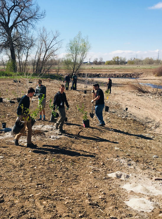
Over the past fifteen years there have been several significant river restoration projects completed in the Poudre zone properties in the downtown area. Two relict diversion dams were removed (the Josh Ames and the Coy diversion). Three major natural areas restoration projects were completed at North Shields Ponds, McMurry, and Kingfisher Point. These river and floodplain restoration projects rely on cross departmental collaboration to lower riverbanks, reconnect the river with its floodplain and improve habitat connectivity and quality in the river.
Weed Control, Prescribed and Wildfire, Grazing
The Natural Areas Department engages in routine noxious weed control on all sites that it manages. Weed management actions are based on an Integrated Pest Management philosophy: a combination of chemical, mechanical, cultural, and biological treatments. Mowing and herbicide are two of the most commonly used management tools in the Poudre zone.
Stimulating disturbance through various means is an essential tool for promoting native habitats. Given the smaller size of Poudre properties and proximity to urban development, fire has been used been only occasionally in the Poudre Zone. Similarly grazing by domestic animals (e.g., cattle or goats) has been used less frequently in the Poudre Zone compared to most other Zones. The primary and most effective natural mechanism for providing disturbance along the Poudre is flooding so restoration efforts aim to create the best physical conditions for natural flooding to occur.
Managing water resources
Even though water is the defining feature of the Poudre Zone, Natural Areas has little influence and control in managing the actual water as a resource. The importance of flows in supporting riverine habitats cannot be understated. Human manipulation and management of Poudre water has already significantly changed the timing and volume of flows. Current threats indicate we will likely further reduce springtime flows. So in additional to direct onsite property management, the Natural Areas Department also engages in various regional initiatives that seek to protect or enhance river flows.
Beyond river flows, water in this zone is managed in ditches, ponds, and creeks. Mostly, these require little management or are managed by another organization (e.g., ditch or reservoir company). Water quality concerns in Poudre River Zone ponds do not currently require immediate attention but this could easily change. Harmful algae that can be a nuisance or cause fish die offs can occur and are often caused by excessive nutrient run-off from surrounding properties, shallow water depths, and fluctuating water flows

Monitoring and adaptive management
The Poudre natural areas make up only a small piece of the entire 126-mile-long Poudre River ecosystem. While the Natural Areas Department focuses primarily on optimizing management outcomes through direct management on Poudre Zone properties, recognition of the complex relationships between riparian habitats and overall river health also leads the Department to support data and monitoring programs for system wide parameters. This enables us to continuously learn when, where and how to adapt management efforts for better results. The Natural Areas Department leads or supports numerous larger scale data initiatives including the State of the Poudre Repot Card, bird surveys, fish and insect monitoring, and water quality programs.
The Cache la Poudre River has been an important resource and location for humans for at least 12,000 years. The Arapaho, Cheyenne, Ute, Kiowa, Comanche, Sioux, Pawnee, and possibly Shoshone, all used the area. To learn more about the indigenous peoples’ use of the region prior to the arrival of Europeans and Euroamericans, you can read the People of the Poudre document created by the Poudre Heritage Alliance, or watch the video of Arapaho elders speaking about the Poudre River, Fort Collins Before: Native Americans.
View all Plans and Policies
View additional plans and policies for Natural Areas such as the master plan, zone management plans, policies, and research.