Plans and Policies#
City plans and policies are essential frameworks that guide the growth, development, and sustainability of a community. These strategic documents provide a roadmap for how a city envisions its future and how it intends to address various challenges and opportunities. At the heart of these plans is the City's comprehensive plan known as City Plan, which serves as the foundational blueprint for the future of Fort Collins.
Plans in Progress#
City Plan#
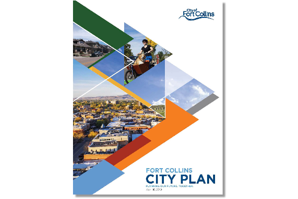
City Plan is Fort Collins’ comprehensive plan that guides how the community will grow and travel in the next 10-20 years. City Plan describes our community’s vision and core values, as well as providing policy guidance and implementation actions to achieve both. City Plan includes guidance on future land-use, transportation, and was coordinated and developed alongside an update to Fort Collins’ Transit Master Plan.
Subarea & Neighborhood Plans#
A subarea or neighborhood plan is a localized land use strategy within the city, honing in on a specific neighborhood or district. It complements the city's comprehensive plan, providing tailored policies for zoning, transportation, infrastructure, and community amenities. Developed through community engagement, these plans aim to guide sustainable growth, preserving the area's identity while addressing its unique challenges and opportunities.
-
![map]()
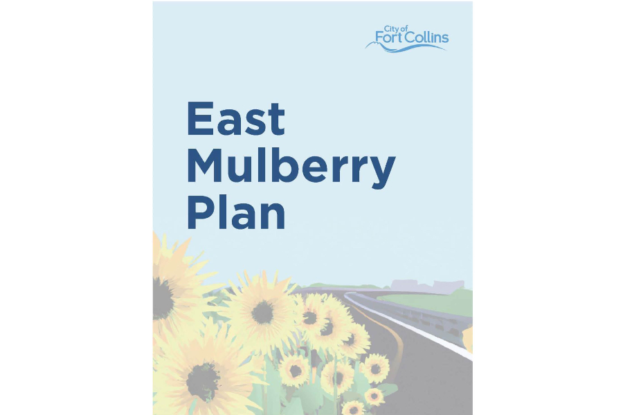
The East Mulberry Plan is an update to the original 2002 East Mulberry Corridor Plan. This plan guides future development and policy decisions for the East Mulberry Corridor. This geography includes the East Mulberry Enclave, which is an area that is made up of unincorporated Larimer County properties that are surrounded by the City of Fort Collins. The East Mulberry Plan lays out a potential path for future annexation of the enclave, as well as highlighting community goals such as improving deteriorating infrastructure and establishing more community amenities.
The East Mulberry Plan is broken down into five distinct sections:
- Introduction
- Character Areas
- Goals & Strategies
- Implementation
- Annexation Thresholds
-
![map]()
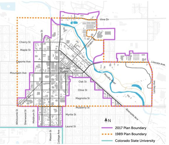
The Downtown Plan encompasses more than the historic core of “Old Town." The Plan boundary incorporates areas planned and zoned for commercial activities, stretching from Vine Drive south to the Colorado State University campus and from Canyon Avenue eastward to Lemay Avenue. The Downtown Plan introduces a wide range of goals, as it covers a growing regional market that serves as a hotspot for both residents and visitors of the city. Some of the goals included are improving the urban design of new construction, strengthening wayfinding and transit frequency, increasing residential development, and improving affordability for housing and commercial spaces.
-
![map]()
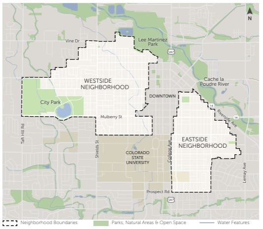
The Old Town Neighborhood Plan (Plan) is a combined update of the Eastside and Westside Neighborhood Plans developed in the 1980s and provides a renewed vision and policy guidance for the two neighborhoods. This plan seeks to address new and ongoing neighborhood issues and opportunities and provides details on programs, strategies, and actions to support neighborhood quality of life in topic areas such as land use, transportation, housing, sustainability, and more.
-
![map]()
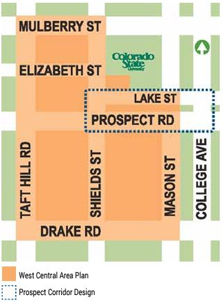
Initially adopted in 1999, the West Central Area Plan was updated in 2015 as a vision and policy direction for the Central neighborhoods between Mulberry and Drake, on the Western side of College Ave. The West Central Area Plan contains policies, programs, and action items intended to support the quality of life in this core area of the City. Key topics for improvements in this core area included transportation and mobility, land use & neighborhood character, and open space networks.
-
![map]()
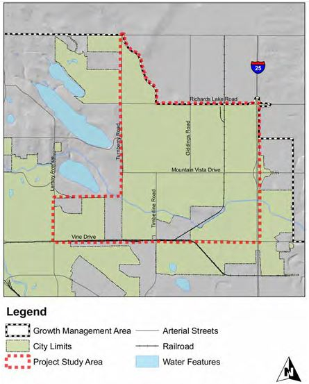
The Mountain Vista Subarea Plan, originally adopted in 1999, laid a framework for a large, primarily undeveloped area of northeast Fort Collins at that time. With approximately 1,500 acres of vacant land at the time of adoption in 2009, the subarea was projected to accommodate a significant portion of Fort Collins' future growth. The plan outlines goals to create mixed-use neighborhoods that have efficient street and trail connectivity, support different modes of transportation such as walkways, bike lanes, and access to transit, and to focus on preserving the open lands through expanding park and recreation space and protecting existing natural areas.
-
![map]()
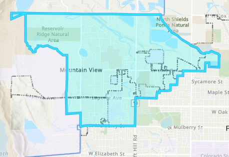
The Northwest Subarea Plan, initiated by the City of Fort Collins and Larimer County, represents a joint planning effort of the City and County involving residents, landowners, businesses in the area, and other interested parties to create a shared vision and plan for the future. Extensive public involvement–including Northwest Subarea residents, landowners, businesses, and others–shaped the priorities and policies of this Plan. This plan, strongly based in citizen involvement, outlines that the existing character area is to be retained and enhanced.
-
![plan area]()
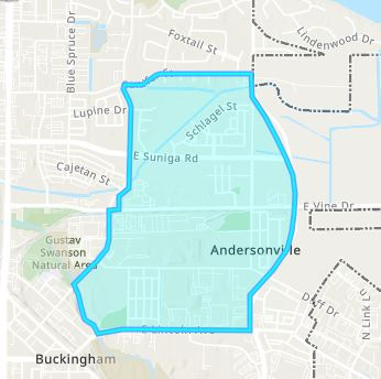
The Northside Neighborhoods Plan area (Plan Area) is located at the northern end of Fort Collins. It encompasses 444 acres—almost one square mile. The Plan Area is bounded by Conifer Street to the north, Lemay Avenue (9th Street) to the east, East Lincoln Avenue to the south, and Redwood and Linden Streets to the west. With the plan area immediately adjacent to the Poudre River, it highlights the conservation of water and energy resources as a goal. Other goals identified include fostering the growth of local businesses, providing livable and affordable housing, and preserving the cultural and historical qualities of the Northside Neighborhoods area.

Corridor Plans#
A corridor plan is a strategic document outlining the development of a specific linear space, like an urban or regional corridor. It addresses land use, transportation, and community development, aiming to enhance connectivity and sustainability. The plan involves collaboration among stakeholders and includes elements such as zoning regulations, transportation improvements, and community engagement initiatives. The goal is to create a balanced and vibrant corridor that supports economic growth and mobility while respecting the unique needs of the communities involved.
-
![map]()
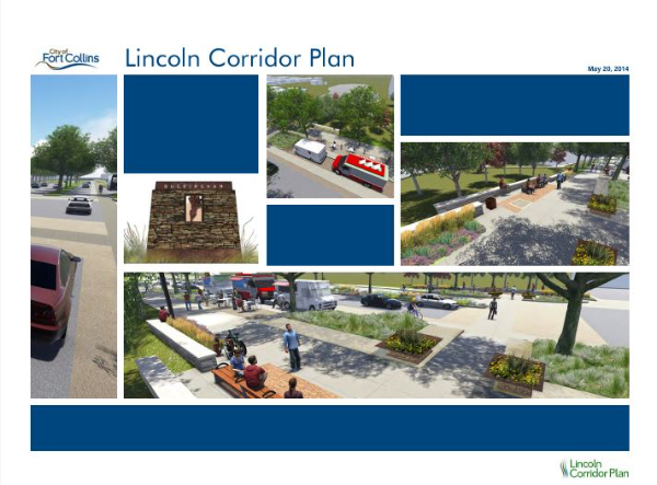
The Lincoln Corridor Plan was created by FC Moves and Planning staff with two primary objectives. First, to develop the ultimate multi-modal roadway design for Lincoln Avenue from Jefferson Street to Lemay Avenue. Second, to identify and implement related neighborhood improvement projects in the planning area. This includes projects such as recommendations for related corridor projects in the area, project funding options and phasing, and implementation strategies and actions for transportation focused goals.
-
![plan cover]()
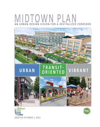
Midtown is a key portion of the College Avenue commercial corridor, spanning slightly over three miles from Prospect Road on the north to Fairway Lane on the south. The Midtown Plan was created with the influence of various studies, plans, and regulations that covered the Midtown Area previously. Bringing together concepts and values from these previous documents, the Midtown Plan serves as a policy guide for the College Avenue commercial corridor. The Midtown Area was noted as the “community spine,” with the City’s first Bus Rapid Transit (BRT) and prioritized investments in streetscape and infrastructure upgrades.
Midtown In Motion (College Ave Transportation Study)
-
![map]()
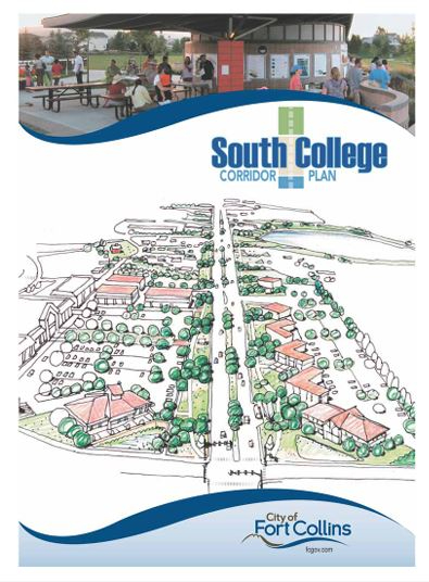
The South College Corridor Plan centers in on the southernmost area of the City along College Avenue. As a gateway into the City, this Plan uniquely covers goals, policies, and implementation strategies that were expressed by business and property owners, residents, and even CDOT and other stakeholders.
-
![plan cover]()
The North College Corridor Plan was developed in 1994, and updated in 2007. The North College Corridor is located in a unique geography, once situated on the Dry Creek Floodplain that was removed in 2006. After the floodplain removal, this plan outlines the goals for the North College Corridor, including creating connection to Downtown and enhancing the corridor as the City’s Northern entryway, while highlighting the existing character and history of residents.
-
![map]()
The Harmony Corridor planning area extends for five miles, from the I-25 interchange to the Burlington-Northern railroad tracks located west of College Avenue. The area extends approximately one-half mile north and south of Harmony Road. As a heavily traveled corridor for residents, visitors, and commuters, the Harmony Corridor Plan outlines goals for creating a beautiful entryway to the City of Fort Collins. The Plan outlines potential of developable land and already established housing, schools, shopping, and recreation facilities, and creates a vision for the future of the diverse and dynamic Harmony Corridor.
-
![plan cover]()
The I-25 Subarea Plan outlines a vision to create a mixed-use corridor along I-25 that reflects the area as a gateway into Fort Collins. Planned commercial and employment centers are intended to provide a broad range of employment opportunities. Goals include establishing an interconnected transportation network that allows easy access to I-25, as well as connections independent of the interchange locations for local travel.

Other Plans#
The City of Fort Collins has many documents that guide how the community will maintain and grow the built environment over the next 10 to 20 years. These plans help us to live into our community values such as livability, sustainability and community. Find a directory at this link: