New & Upcoming Historic Surveys
The City of Fort Collins has some new survey projects moving ahead to help us better understand the important historic and architectural places that define the community. Here are some of our recent and/or active projects:
- Mid-20th Century Religious Facilities (active) - the City is actively completing an historic survey of our mid-20threligious buildings. These properties both reflect some of the city's most significant examples of mid-20th century Modern architecture, but many religious organizations are exploring new land uses that align with their mission in the community. This project is intended to acknowledge the important role these institutions play in the Fort Collins community, and equip those institutions with knowledge on their potential land use code responsibilities. Results are expected in late 2026.
- North College Avenue (active) - the City is actively completing historic survey of the commercial corridor on North College Avenue between Maple/Jefferson and the Larimer & Weld Canal. This survey is exploring surviving agricultural properties, roadside/midcentury Modern properties, and other stories that have come to light as a result of research. With many transformations expected on North College in the coming years, this survey aims to equip property owners with knowledge on potential land use code responsibilities relative to historic resources. Results are expected by early 2026.
- Laurel & College (2025) - the City completed an historic survey of the commercial node at Laurel Street and College Avenue that has served the northeast campus area since the early 1900s. Results were finalized in the fall of 2025 and recommended a few new Landmarks as well as a small Landmark District.
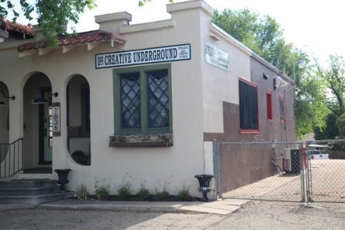
- College Avenue Downtown (2023) - the City secured a State Historic Fund grant to survey College Avenue between Mulberry Street and Laporte Avenue. Results were finalized in 2025 and made recommendations for new Landmarks and potentially a new district, or expanded Old Town District.
What is Survey?#
What makes an historic place "historic?" It's not just how old it is, or if someone important lived there - there's a lot of ways that a place might be historic, and it usually requires a little digging through historical records to find out.
Survey is the process of documenting and researching specific areas or places in a community to determine what is important enough to save. As part of a survey, a particular property and/or area is photographed and mapped, and its history is thoroughly researched. That research includes the relative importance of the styles or types of buildings in that area, the connections the buildings and other resources in an area have to important events or trends in history, and the importance of specific people, groups of people, or ethnic groups to Fort Collins. It also includes a recommendation on whether a place qualifies for formal historic designation by the City of Fort Collins, State of Colorado, or federal government.
How are Survey Results Documented?#
Most survey projects result in the production of both a report and survey forms. The report documents how the surveyor completed the project (methods and techniques), the history of the area being surveyed (usually called an "historic context"), and the general recommendations about the area. A survey form includes documentation on a specific property or resource, like a building, structure, or site. Survey forms usually come in two types:
- Reconnaissance Level (or Recon) - these are short and fast, providing very basic information about a property but usually very little historical information beyond the year of first construction. These types of forms can also record whether a property is contributing or non-contributing to a larger historic district (in other words, that it does or does not reflect the important history or architecture of a larger historical area). The City generally does not use this form type unless documenting the status and extent of an historic district.
- Intensive Level - these are detailed forms that document as much historical information as possible on the property and fully evaluate whether it can be a City Landmark under any of the four criteria outlined in City Code. They require a significant amount of archival research about the property but are also the best to determine accurately whether a property is eligible for historic designation. The City generally uses this level of survey for properties constructed prior to 1950, or properties proposed for demolition.
Survey Reports#
| Project | Year | # of Properties | Source |
|---|---|---|---|
| Laurel & College Commercial Node | 2025 | 48 | City - Historic Survey Specialist |
| College Avenue Downtown | 2025 | 50 | City - State Historical Fund Grant |
| Downtown West Area Survey | 2020 | 176 | City - Historic Survey Specialist |
| Mountain Avenue Downtown Survey | 2020 | 48 | City - Historic Survey Specialist |
| South College Avenue Corridor Survey | 2019 | 192 | City - Historic Survey Specialist |
| University Acres Neighborhood | 2019 | 327 | City - University Partnership |
| Loomis Addition Survey Report | 2017 | 282 | City - State Historical Fund Grant |
| Postwar E-X-P-A-N-D-S Survey (Mid-20th Century Development) | 2011 | 100 | City - State Historical Fund Grant |
| The Sugar Factory Neighborhoods: Buckingham, Andersonville, Alta Vista | 2004 | 175 | City - State Historical Fund Grant |
| In the Hallowed Halls of Learning: The History and Architecture of Poudre School District | 2004 | 34 | City - Certified Local Government Grant |
| Quonset Huts in the Fort Collins UGA | 2003 | 33 | City - Advance Planning Fund |
| Cultural Resources Inventory of the Old Fort Site | 2002 | 35 | City - Certified Local Government Grant |