Dry Creek#
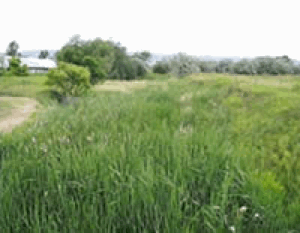
Dry Creek upstream of Shields Street in the upper basin.
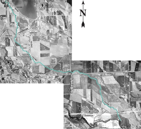
Dry Creek, which is a tributary to the Poudre River, extends from near the Wyoming border to where it joins the river near Mulberry and Timberline. The Dry Creek Basin is approximately 23 miles long and six miles wide and encompasses approximately 62 square miles. The land use in the upper and middle portions of the basin is primarily rangeland and irrigated hay meadows and pastures. The majority of the lower basin is developed and includes commercial, industrial and residential uses. The natural channel has disappeared in some areas of the lower basin because of urbanization.
The 100-year floodplain and floodway were originally mapped as part of a FEMA Flood Insurance Study in 1979. In 2002, Fort Collins Utilities mapped a revised floodplain and floodway for the basin as part of a comprehensive update of the City's stormwater master plan. Below the Larimer and Weld Canal (the lower portion of the Dry Creek Basin) there are an estimated 600 structures damaged during a 100-year storm.
A major flood control project in the upper portions of the basin will mitigate most of the flooding damage in the lower portion of the basin (below the Larimer and Weld Canal). However, improvements in the lower portion must also be constructed to remove all the estimated 600 structures from the floodplain.
The master plan update is currently underway. The goal is to address stormwater quality from rainfall runoff and to identify stream restoration projects that protect the city's watersheds.
Flooding History#
Dry Creek is a tributary of the Cache la Poudre River. The Dry Creek basin, which begins near the Wyoming border, has a drainage area of about 62 square miles with a series of irrigation canals and reservoirs dominating the upper basin. Due to agriculture and development, only a fraction of the original drainage channel remains. Dry Creek enters Fort Collins near Willox Lane and College Avenue and meanders through small remnants of ditches and channels until it joins the Cache la Poudre River near Mulberry Street and Timberline Road.
Although local newspapers reported numerous floods over the last 100 years that affected different areas in and around Fort Collins, many floods in Dry Creek probably went unnoticed due to the sparse population in the upper basin. A local resident documented that in 1924 there was flooding that was "belly deep to a horse" in the area that is now a retail store, JAX Outdoors.
In the August 1951 flood, the Coloradoan reported that two breaks in the Eaton Ditch (Larimer and Weld Canal) spilled over into Dry Creek and "flooded tourist camps, stores and houses on the west side of North College Avenue north of City limits." In the same storm, another 20 houses flooded in the Goering Addition, west of the old speedway track at the northwest corner of Willox Lane and College Avenue. In 1977, another storm brought 4.28 inches of rain in 24 hours, flooding basements north of town, most likely in the Dry Creek basin.
In spite of the small number of reported floods in the Dry Creek basin, it contains a very large drainage area - significant flooding could occur at any time.
Maps & Newsletters#
- Problem Identification Map (PDF 50KB)
- Flooding Solution Map (PDF 39KB)
- Water Quality Solution Map (PDF 14.7MB)
Learn more about the Dry Creek Drainage Improvement Project.
Did You Know?
Fort Collins Utilities monitors water quality in our water sources, treated drinking water and treated water returned to the environment.
Even small projects like planting a shrub require you to plan before digging. Know what’s below. Call 811 before you dig.
Rebates are available for 1.1 gallons per flush, WaterSense-labeled toilets.